Montserrat

For the final day of my trip I planned a visit to Montserrat, the ‘serrated mountain’, which is about 25 miles from Barcelona and had the dual attractions of hiking opportunities and a monastery complete with boys’ choir who sing daily. A day on a mountain followed by Vespers seemed the perfect way to bring my trip to a close, but the practicalities weren’t as easy to bring together due to the timings of the last train/cable car down from the mountain. I had an early start, but managed to find time for a short stop at a cafe for my now traditional cafe con leche, accompanied by a croissant, on the way to the metro.

The connection to the train was uneventful, helped by the convenient numbering system which makes it easy to identify both the right platform and the right train when it arrives. I had to stand for the first 15 minutes it so, but once we had left Barcelona there was a bit more seating room. The highest point of Montserrat, Santa Jeroni, is 1236m which, if it were in Scotland would put it up there with the ten highest mountains. It’s all the more striking as it’s not surrounded by other mountains and really looms over the town of Monistrol at its foot.

Although there is parking on the mountain, the typical tourist options are to take either the cable car or the rack railway (Cremellana) up to the abbey. I had decided though to hike up, and had the choice of two routes. When I got out of the train at Monistrol Aeri (where the cable car also starts) I looked up at the side of the mountain and it looked pretty daunting. It’s a steep mountain with quite a lot of rocky outcrops and I wasn’t too sure whether I would cope with the exposure of the path. I did briefly consider taking the cable car up and saving my hiking for the top of the mountain but I really wanted to do what I’d set out to.

Cable car approaching Monistrol Aeri

After a short stretch along the side of the main road, the path off to the monastery was easy to spot (one reason I’d chosen this route rather than the alternative that set off from the next station) and I was soon on the mountain side. There were a few scrambly bits that made a little uncomfortable but nothing too bad. The climb was steep, but not ridiculously so. I’d hoped to have put a little more hiking time in the legs over the past week than I achieved, but even so, I feel like I’ve a bit more strength than I’ve felt for a while.

Tile showing monks, the abbey and the Virgin of Montserrat on the side of a building where the path left the main road
The start of the path

The path was well marked, and I never had any issues with finding it, even through the scrub, much of which was made up of rosemary bushes. Having reached about 300m though I was struggling. There were a couple scrambles which I found uncomfortably exposed and a big stretch. I could see on the map though that the path was going to level off a bit following the contour of the mountain, before joining what looked to be a bigger track. I was hopeful that the hardest stretch was over and that I might feel better, but this turned out to be the worst bit as the path was all of 18” or so wide and with only some low bushes between the edge of the path and thin air. I managed a very short stretch and realised I just couldn’t go on, especially knowing that there was still about the same amount of climbing left to me. I was about half way along this stretch so turning back wasn’t necessarily any better than continuing except that I had no idea what was ahead for the rest of the walk. I had a suspicion it would be better but wasn’t confident enough in that suspicion to continue.

The path was very gentle to start with
View from the mountain side
A friendly section of path
Somewhere around the point where I lost my nerve, although I’d put my camera away by that point as I couldn’t cope any excess movement/weight

So, with shaky legs and palpitations I made my way back, hugging the mountain side and clutching every prickly plant along the way for security. Writing this now (on the plane home, with ironically an even great drop out of my window) I can feel the same squirming in my stomach and sensation of panic building up. I’d walked about 45 minutes uphill and now I had to retrace by steps, along with quite a bit of bum-shuffling down the scrambles. On the way up I’d thought how I’d not like to do the path downhill, but the relief of getting off the mountain side helped. I had one small stop to watch a very determined ant trying to climb up the side of the rocks along with what looked to be a piece of insect exoskeleton that was huge in size compared to its own body. It kept falling back down and then doggedly carrying on back up. That really put my struggles into perspective.

Very vali-ant

By the I reached the cable car station again I was feeling rather despondent. Two routes up the mountain remained to me, the cable car and the rack railway, whose station was about a 45 minute walk away. The cable car seemed the logical option but, still feeling a bit trembly, a bit daunting. I was beginning to think I had taken on something that was beyond me, but I was determined to get up there, so I stood in the queue for the cable car and had about an hour to collect myself as a train had disgorged a large number of passengers just as I arrived and the cable car could only take 28 at a time.

Finally I was shepherded onto the cable car and tried to squash my nerves, taking a spot right in the middle and distracting myself by chatting with a group of Americans and their tour leader. The journey was ok, and the views spectacular, but when we arrived at the top I needed to scuttle away quite quickly through all the people who were dithering around near to the exit so that I could find a spot a little less close to the edge where I could relax a little. It’s an odd experience arriving at the little village which is perched on a crevice in the mountain at about 700m altitude and is bustling with activity with hotels, restaurants and plenty of cars parked up, I’m more used to Scottish mountains after all.

Gateway to the village of Montserrat
The village of Montserrat

My first stop was at the tourist information to ascertain whether I would be able to get back off the mountain using the train after vespers. Oh yes, no problem was the answer. The last train down to the bottom goes at 7.15 and vespers will be finished by then. I had a few doubts but as there was one further train that only went partway to a car park at least there was a back up option.

The second order of business was to get a hiking map and some advice on whether the paths were going to be just as scary as those of the way up. I had the feeling that the staff may be trained to discourage people from the path to the summit at Sant Jeroni which was the longest hike they described but still only estimated as 1h15min walk in each direction. With a couple other options circled on the map and my confidence low I headed to the funicular as it gave me access to a walk back down to the monastery. I felt discouraged, to be honest, that I wasn’t doing what I set out to, but having ‘cheated’ by taking the cable car up I could no longest be purist about my hike, which has actually been a pretty good theme for this trip!

There are two funiculars on the mountain, the other of which is currently out of action, and I was horrified to see workmen climbing on it from the cable car. The funicular journey was a short  trip taking us up about 230m over a distance of 500m. At the top I was reassured to see lovely wide paths, more at home in a country park than up a mountain but very reassuring to me at this point.

The hiking routes from Pla de les Tarantules, at the top of the Sant Joan funicular

Feeling a bit better, I decided to start with a 45 minute out and back hike to a number of chapels. The views were tremendous but still rather shaky I was hugging the inside of the path, shuddering at the people on the outside of the path posing for selfies. It was around that stretch that I got talking to an Australian lady, who was roughly of Mum and Dad’s vintage. She and her husband were on a 9 week tour of Europe and I was curious to know where they’d been. Imagine my surprise to find that not only had they just come from Manchester, but that they’d stayed with family in the house 3 doors down from Granny’s house. This little coincidence gave me a great boost, and made me feel better about the way my day was going as I would most likely never have bumped into her if my day had gone according to plan. In the end I made it most of the way along this trail, but turned around a little bit before the end when the trail narrowed and became more exposed with a scary looking set of steps. Exciting perhaps only to me on this section where what I believe to be alpine swifts swooping back and forth over our heads.

Sant Joan’s chapel in the background
Path to Sant Joan’s chapel
The final stretch before I turned around and walked back
Looking down to Sant Joan’s chapel

Having regained some confidence and with about 4 hours ahead of me until vespers I decided I had plenty of time to attempt the longer walk to Sant Jeroni as had been my original plan. This trail was certainly less popular than the other and narrower, but had good barriers on the side where necessary and felt fine to me. Finally I felt like I’d escaped the more touristy side of the mountain and could enjoy the scenery and the experience a bit more. The mountain truly is dramatic, with steep drops and huge vistas along with giant rock formations some of which were being tackled by climbers. The times when the path passed through the woods gave some much needed shade and a bit of relief from the exposure that still caught me out now and again. The main part of the climb up to the summit comes towards the end of the hike and whilst it was effortful, I’ve done harder hikes, although before I became too smug it shouldn’t be forgotten that I had skipped an uphill section at the start by taking the funicular. There was a big party of primary school kids who seemed to have managed it and were all smiling and happily high fived me with a cheery hola when I stopped to let them past.

Sant Jeroni path – there were climbers on the rocks ahead
If you look hard you can just about see the winding around the rock formations
View back down to Montserrat
More rock formations with a paraglider
A little respite from the sun
The views approaching the summit were fantastic, but unfortunately my camera battery was empty by this point and I had to rely on my phone for the rest of the hike
Another view of the rock formations

The last 30m or so of the climb took you up a set of steps built into the rock formation. I was dubious I’d manage it, but figured I’d try it. I only got a couple steps up before deciding that it really wasn’t for me. I was, I’ll admit, somewhat comforted that the lady coming up behind me only got a couple steps further than me before coming to the same conclusion.  I was a little sad not to see the views from the very top as there’s something special about a full 360 degree vista but I suspect I wouldn’t have been able to enjoy it much! Time then to turn tail and hike back to the monastery. I stopped for a few minutes to look at the Sant Jeroni chapel which had been surrounded by a group of chattery Germans on the way up but was now deserted. It was another plain building, most notable for the presence of a desfibril-lador (defibrillator) on one side. I’ve seen plenty around in public areas on this trip but this did seem the most bizarre location.

The final set of steps heading up the rock formation and someone at the summit at the back of the photo
Chapel of Sant Jeroni

Not long after the chapel the return path to the monastery split off and wound downwards through the woods. My feet were beginning to feel the weight of the day’s walking by this stage, although my legs felt as strong as the start. I enjoyed the wooded section but the last part of the walk was a bit daunting with an endless set of steps winding along the side of the mountain again, twisting and turning to its contours. It certainly wasn’t as exposed as previous sections but it did feel a bit daunting coming at the end of the long day. It was quite a relief to catch sight of the village ahead and walk down the last steps and find myself a bench to sit on and rest.

Downhill through the woods
The rock formations never failed to appeal
A nice set of steps, with no drop to either side
The village was finally back in sight, though it still felt too far away on tired legs
A welcome sight for tired feet

I found myself back with about an hour and a half before Vespers so I thought I’d find something to eat. Despite being a touristy site though, nowhere was serving food it being too late for lunch and too early for dinner. Time then to dig out the emergency chocolate ration that I’d purchased before setting of on my hike. Apparently made by the monks and flavoured with crema catalana. To be honest it was rather odd tasting and I can’t say I’d recommend it.

The basilica was a rather dark building and very ornately decorated. Truthfully I was too tired to appreciate it. Although early for Vespers I found myself a pew and allowed the praying the Rosary to wash over me. High up behind the altar is a statue of the Virgin of Montserrat, and there was a steady stream of people climbing up to her and paying her homage. As the Rosary came to a conclusion, the monks started filtering into the pews around the altar. Expecting a procession of choristers to follow I was disappointed when one of the monks opened the service and I realised that there was to be no choir that day. Still, there was something very evocative about being part of this daily office and thinking about the monks living their lives up on the mountainside. The service was in Catalan, and reminded me that I’d read about the monastery being a protector of the Catalan language and people. It wasn’t the musical experience I’d been looking forward to, indeed some monks were clearly more musical than others, but an emotional one nonetheless.

The outside of the Basilica
Interior of the Basilica

As the service drew to a close I rushed out to catch the train down only to find, as I somewhat suspected, that I’d just missed it. Fortunately my feet were feeling better after their short rest as I was going to have to walk the final stretch to the station after all. After 15 minutes of waiting I was the only passenger in this last train down and very glad of its warmth. After some stumbling around the multi-storey car park I found the way out and was relieved to find myself within the little town of Monistrol in a matter of minutes and not walking along a dark road the whole way as I’d feared. This walk I’d dreaded became something to enjoy as the village was quite attractive even at night, and I thought that in daylight it would be worth making the walk up to this other station rather than taking the train from the main station just have a better look.

I didn’t stop to read the information, but I assume this was the original train up to the village (at Monistrol Vila station)
Monistrol at night
Monistrol at night

Finally at the station I had another 20 minute wait for the train back to Barcelona, and eventually arrived there at about 10pm. Although I was worn out and had another early start in the morning to catch my flight, I took advantage of Spanish restaurant hours and stopped at one of the places I’d visited the night before. I’d seen a tempting plate of what looked like wild mushrooms being brought to another customer, so the garlic mushrooms seemed like a good choice and then with the help of google translate, I decided on Cazón en Adobo (fried, marinated fish). The mushrooms, when they arrived, were sadly just your typical garlic mushroom, nothing wild about them, but good nonetheless. The fish was delicious, with a very good herby coating. I walked the remaining 5 minutes back to my lodgings feeling that my day had been a success although certainly not as planned.

Cazón en Adobo

Palamos to Sant Feliu de Guixols

After a poor night’s sleep due to the heat, the first order of the day was to venture into the local Lidl, conveniently across the road from my AirBnb to try and find some plasters for the blisters on my left foot and a new iPhone cable to replace the almost useless one I’d brought with me. I succeeded with the plasters but no joy with the phone cable so I followed GoogleMaps to a local electronics store, which turned out to be closed despite its stated opening hours. I thought about not bothering but given that the phone/iPad hold all my information for the trip decided that it was worth continuing onwards to the next shop on offer in the opposite direction to today’s planned hike, after stopping to patch up my feet! As luck would have it, I rounded a corner to find a ‘dollar store’ type emporium and could see a display of cables from the street. Problem solved, it was time to turn around and head southwards along the beach.

The first 3km or so were indeed along this very long stretch of beach and I began to feel that I would never leave Palamós.

Looking back towards Palamos

And ahead to Sant Antoni

A middle aged gentleman (I feel I must stop saying this as I may be classed as middle aged myself now) passed me 3 times on his roller blades and there were plenty of dogs being walked. The forecast was for rain today and there were a spots but nothing that amounted to a shower. Finally the end of the beach came into sight and with it the promise of some more interesting scenery.

Almost as soon as the path left the long beach and turned a corner away from Palamós there was a drop down to a small rocky beach. It was clearly sign posted with a cross indicating that it was off the walking route but I was keen for a small sit down to enjoy the solitude and view. I was joined about 2 minutes later by a couple walking their chihuahua, who was sporting an Adidas hoodie (well, I think I may have imagined the hood) who was very interested in the macadamia nuts I was enjoying for my breakfast.

Ignoring the sign not to take this path

I’d been a little unsure what to expect from this stretch as from the map it looks rather built up. The great thing about this coast though, is like a good ecosystem, it is built up in layers and to each their own habitat. At sea level, some stunning coves each differing from the last. After 3 days it still surprises me how one beach will be fine sand, the next rocky and the next large grained sand. A little above sea level are the paths, hugging the hillside and dipping down to wander along the beaches. Higher still are the houses I could see marked on the map, but they mostly didn’t intrude, although they often have their own beach access via the main paths.
I find the pathways between the beaches almost as appealing as the scenery itself, and there was plenty of variety today, including a few tunnels through the hillside. There was one place where you had to clamber over the rocks between one beach and the next, and timing was key to avoid a splashing.

Although the plasters had helped I was struggling a bit because of the blister on the sole of my foot and never managed to get into a comfortable walking rhythm, frustrating as my legs were full of energy. The scenery was fantastic, though, and I stopped for many photos along the way. I was amused to come across one small beach whose sign had been ‘updated’ to indicate that nudists were at large and photography was therefore prohibited. With not a single nudist in sight I disregarded their instructions!


As I approached Platja D’Aro the anticipated rain made its appearance. By this point I was beginning to think that walking the whole distance to Sant Feliu might not be the smartest idea, particularly given the two longer days of hiking (with plenty of climbing) still to come. My plans having been very much determined by availability of places to stay and public transport back to Barcelona at the end of the trip I knew that today was also the easiest day to cut short as the bus I’d taken to Begur stopped at Platja D’Aro, S’Agaro (the next town along) and Sant Feliu. With two possible exit routes in mind, I thought I’d stop for lunch and see how I felt.

Finally I rounded a corner and Platja D’Aro was in full sight. Never have I been so glad to see a rather uninteresting looking beach town! Even this close to town there was a fantastic little beach with glorious clear water and I really wonder why people are attracted to dull, long, sandy beaches. Although, as it was raining heavily by this point there was nobody sunbathing anywhere.

Platja D’Aro in the distance

I didn’t spend any time trying to identify the best lunch option, but simply took advantage of the first place I came to. It was bright and friendly, but there was only myself, two North American girls and a middle aged Brit at the table next to me who somewhat disconcertingly held an audible, but incomprehensible, conversation with his beer throughout the duration of my meal. I’d intended to take advantage of the menu del dia but having been handed a full menu I choose from that instead. The challenge of being a solo traveller in Spain is that many dishes are really intended for sharing, and certain items, such as paella are generally only available for 2 or more people. Given they had the option of a single person paella I had to go for it although I knew it wasn’t likely to be the best one as a result. I also ordered a portion of patatas bravas ignoring the advice ‘dishes for sharing’ at the top of the page. Well, they were delicious, and despite the vastness of the portion I ate them all, and still found plenty of room for my paella. Having noted yesterday that drinking at lunchtime was probably not the best of ideas with an afternoon of walking ahead, I nevertheless ordered a glass of red wine in the knowledge that my walking day was done somewhat sooner than expected.

Patatas bravas
Paella

Having polished off this vast quantity of food I looked at the bus schedule I’d so helpfully stored on my phone. I nearly deleted it having completed my journey to Begur, but I’m glad I didn’t. There was a bus due in 20 minutes, and the next one wasn’t wouldn’t be along for another 2 hours, so I packed myself up without a coffee and headed out into the pouring rain. The waiter looked horrified as I left and suggested I stay a little longer. ‘Autobus’, I replied sadly to explain my rush. ‘Ah, si’, said he, and let me go. Thankfully the bus stop was only a 5 minute walk from the restaurant and in no time I was on my way to Saint Feliu de Guixols. Although I may have missed some more good scenery the weather was miserable and I was also saved some trekking through town which looked decidedly uninteresting.

20 minutes later I was in Sant Feliu and found my hotel easily, just a few minutes walk from the bus station and opposite the monastery, which I thought I might investigate later. The hotel wasn’t staffed, but a quick phone call and the very friendly owner arrived. His English being much better than my Spanish we were able to converse a little. He looked rather impressed by my plans for tomorrow, which is slightly unnerving, but I am hopeful my foot will be feeling a little better and the weather more in my favour.

The hotel room is basic and old fashioned, but has everything I need, namely a bed (two, in fact!), a hot shower and an electrical outlet. There are very comfy sofas downstairs where there is wifi access, but it took me a while to check those out as having warmed up in the shower I fell asleep for the rest of the afternoon. The rain never did stop, so I probably wouldn’t have have gone out exploring anyway. Finally around 8pm, which is still earlier than most Spaniards would go out for dinner, the torrent came to an end and I ventured out for some food. Most of the options I’d identified on Google Maps were closed today but I found a tapas bar that looked promising. When I arrived the waitress was stood outside smoking and there were no other customers at all. I decided to stay regardless and soon had a plate of Pedron peppers and some delicious garlicky razor clams in front of me. The bar brightened up with 3 more customers during my meal, and I savoured a slow coffee whilst writing this post.

Palamos to Platje D’Aro: 7.07km, 105m ascent/102m descent, 3h20min

Ben Vorlich

To get the New Year off to a good start, Jen and I decided to revisit some unfinished business in Munro form. Last year we visited Ben Vorlich on Loch Earn in decidedly winter conditions. We made it to 677m through knee deep snow before calling it a day and returning home. Conditions this year were very different following a week or so of relatively warm weather, and with a forecast for blue skies and fairly light winds we decided to have another go.

We didn’t get off to the best start having first overslept and then only travelled 15 minutes from the house when a warning light came on in my car indicating that one of my tyres was flat. We returned home, transferred our rucksacks and cups of tea to Jen’s car and set off again, eventually parking up at Ardvorlich at about 11am.

I’ve not done much exercise of late and it was felt like a hard slog from the start with a continual climb from the parking area.  It’s not far before you start to see the bulk of Ben Vorlich in the distance and although we could see hints of sun to the south, the top was in cloud when we set off. As the mountain is directly to the south, the valley was in shadow for the whole of the walk, something I hadn’t thought about in advance but will definitely consider when planning other winter hikes where the sun is low in the sky.

There’s a little bridge by a waterfall which I remember slipping and sliding over last year and we had a quick stop for a drink of water and a piece of chocolate before continuing on to a large rock which we could shelter behind for a slightly longer break for cheese and oatcakes. Having crossed over the water the wind picked up and we began to feel rather cold.

Duly refuelled we headed off again for the climb on to the Sgiath nam Tarmachan (wings of the ptarmigan)​ ridge, which was the point that we stopped at last year. Everything looked very different this time around without the snow to plough through. With unfit legs it was a hard slog, snow or no snow.  We finally reached the top of the ridge and the main summit was in sight before us. There was a sprinkling of snow flakes on the ground and promises of fantastic light up on the summit.

The path zig zagged up over rocks for the final climb and it looked a little steep and daunting. Still, the trig point was in sight. We began to make our way up and then about halfway there, vertigo struck. We stopped. Made the mistake of looking back. Knees wobbled. Tried to encourage each other on, but instead just infected each other further with the vertigo. After a bit of pondering and sighing we turned around and started to head back down. I ended up scooting along on my bottom for the first 10ft before I got the confidence to regain my feet.

It was quite windy by that stage and we were feeling both cold and demoralised. Having not put my gloves on before clambering over the rocks my hands were freezing cold and hunger was beginning to settle in again as well. We made pretty good time going downhill and found ourselves a little shelter for a break. We didn’t stop for long though as we needed to keep moving to stay warm. Finally we approached the bridge again and just a couple feet before it I caught my foot, tripped and flew forwards before landing with a crash on my hands and knees. A bit of swearing ensued and some restorative leaning on Jen’s shoulder before we continued on again. Fortunately no real injuries thanks to the thick gloves and the three layers of leggings and waterproof pants, although 4 days on, I still can’t kneel down without yelping.

By the time we reached the car it was beginning to get dark and we were glad to get inside and warm up. Armed with our reusable bamboo cups we stopped at a pub and acquired a couple cups of tea to keep us going on the way home, along with the hedgehog shortbread I’d made the day before.

At the time I was inclined to think that I’d be happy never to go back to Ben Vorlich, but I’ve already been researching alternate routes up as it definitely feels like unfinished business now!

Ben Vorlich

Late on New Year’s Eve as Jen and I were pondering the day and year to come, we checked the weather forecast for New Year’s Day and decided to plan ourselves another hike. As I was determined to go to parkrun at 9.30, we knew we’d be a little short of time but we figured that if we found something easy (relatively speaking) and local (ditto) we’d have the chance of a good hike even if we couldn’t make it to the summit. After browsing the WalkHighlands website we decided on Ben Vorlich, a Munro in Perthshire which was just shy of an hour and a half’s drive from home.

New Year’s Day dawned earlier than I would have liked, having tossed and turned until 3am despite our restful evening. To add to the excitement, the drain from the sink had blocked the night before, so before heading up to the park I spent half an hour fiddling with the plumbing in the hope of relieving the blockage, sadly to no avail.

Having been absent for well over a year and a half I finished my 30th parkrun on the 4th anniversary of my 1st, in a rather slower time but in good company of friends. Jen arrived a few minutes later, armed with hot tea and we set off to the hills. Within a few minutes of driving the weather deteriorated and heavy rain quickly turned into sleet. Not very promising at all, but we kept hoping that it would improve. An hour later things were still grim and rather than wait until parking the car and getting into our waterproofs in the rain, we decided to make a short stop in Comrie for a cup of coffee and gear up whilst we were there. Jen had the excellent idea of ordering some toast and jam, just what I needed having only eaten some grapefruit and already having run 5K.

When we left Comrie the weather started to dry out a bit, further justifying our decision for a short stop even if it left us with less time until nightfall. At 1pm we parked the car by Loch Earn and set off along the track up to Ben Vorlich. Although the cloud cover was heavy we had some good views of snow covered mountains on the north side of the loch and it looked to be clearing a little. At any rate, it was now dry, which was a huge bonus.

The track took us past some farm cottages and a small wooded area before starting to climb into the hills. There was noticeably more snow on the track than we’d seen on Schiehallion last week, and the stiles proved challenging in their slipperiness.  After crossing a couple of fords the track petered out and we followed a smaller path up to Ben Vorlich who was beginning to show himself through the cloud.

Despite the snow, the path was clear in the snow thanks to the hikers that had preceded us. Although there were a few occasions where footing was difficult, it was a lot easier under foot than the ice we encountered on the path up Schiehallion last week.

The path initially took us along the side of the ridge that leads to Ben Vorlich, but as the first false summit approached it was time to climb up onto the ridge itself. At this point the snow got a lot deeper and we were sinking in up to our knees. We made it up onto the ridge where we met another hiker coming down. As we suspected, we still had quite a way to go until the summit and the going wasn’t easy as the snow was only getting deeper. With sunset approaching fast and the wind blowing snow in our faces we decided that this was as far as we were going to get, and after enjoying the views began the return to the car.

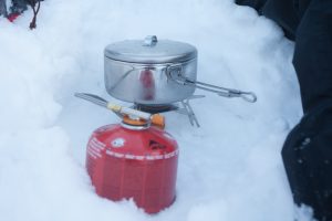
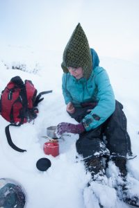
We retreated off the ridge and nestled out of the wind to set up the stove and enjoy the hot chocolate we had prepared.

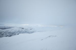
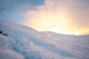
The sun finally began to clear the clouds giving some beautiful light over the snowy hills behind us.

Having enjoyed our drink it was time to get ourselves back to the car. I, for one, had pretty damp feet and ankles by this time as the snow had crept in under my waterproof breeks and I was looking forward to getting into the car and getting my boots off.

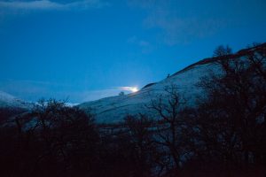
We had one final treat on the way back to the car, watching the super moon rising up from behind a distant ridge and finally breaking free of the clouds. Unfortunately with only a wide angle lens on my camera there was no hope of capturing it in all its glory.

Route: Walk Highlands

Schiehallion’s Redemption

There was just time to get one more hike out of 2017 and as luck would have it, one day of good weather forecast during Jen’s stay with me between Christmas and New Year. Now we just needed to decide where to go, a decision complicated by the recent snow and our lack of both crampons and ice axes and the know how for using them. Fortunately there’d been a bit of a thaw and as we stared at the mountains on the horizon from Kinpurney Hill on Wednesday afternoon it became clear that whilst the Cairngorms were still heavily blanketed in snow, Schiehallion was looking fairly dark in the distance and therefore hopefully more accessible. We decided to go for it, in the knowledge that in the worst case we would just have to turn back if it became impassible.

We’ve actually made a previous visit to Schiehallion back in September, in which we only made it about 2/3rds of the way up, having started mid afternoon on a very dreich day. I have to admit that my heart wasn’t in it that day and every step felt like a huge effort. I don’t think I’ve ever been so glad to turn around and head back downhill and if I hadn’t been with Jen I doubt I’d have managed to coax myself out of the car at all. I was therefore looking forward to having another shot at Schiehallion, but also feeling quite some trepidation as my previous memories of it were so dire.

With the days being so short and with the overwhelming desire to schedule in a visit to the Watermill Bookshop and Cafe in Aberfeldy on our way home we did some careful planning and hoped that our timing wouldn’t be too far off. We arrived at the car park just before 10am, a little later than planned, which is pretty much typical for most of our jaunts! According to the mountain forecast it would be -5C at the summit with a windchill of -15C. Even at the car park it was clear that we were going to need all our layers, not to mention our new winter gloves. Without any consultation we’d each gifted the other a pair for Christmas.

Heading on to the path we could see quite a few walkers ahead of us and Schiehallion’s bulk looming in the distance.

The sun was only just beginning to peek over the neighbouring hills as we set off and the light was fantastic. Already this was shaping up to be a far better day than our previous visit.

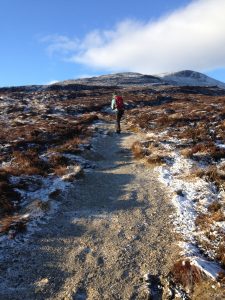
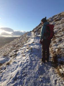
It didn’t take long before we were seeing the first signs of snow on the side of the path and once we started to climb we had to be very careful of icy patches along the way. There were a few Bambi like moments with legs skidding in all directions but no falls! This was where it began to feel like a real slog and I was having a hard time ignoring the little voice that was reminding me how miserable my previous visit was. Fortunately the bright skies and the views were sufficient distraction and even if I had to stop frequently to rest my legs I was beginning to remember how much I love being in the mountains.

About a third of the way up the snow was becoming more evident, although the path was nice and clear. Now that we were getting higher the views were really opening out and I had to make plenty of stops for photographs.

The wind was getting stronger and we were really beginning to feel the cold, so when we saw a big rock to huddle behind we decided it was the perfect moment to get the camping stove out and heat up the hot chocolate that we’d brought with us. I dug out the stove, the gas canister, dropped half the matches on the ground, found the cocoa and then stopped in bewilderment. I was missing something, what was it? Oh. The pan. Rats. Fingers getting numb we packed everything back up again and mourned not only the lack of hot cocoa but the fact that we wouldn’t be able to heat up the thai curry we’d brought either. Having forgotten the CF card for my camera, this wasn’t shaping up to be the most organised of hikes!

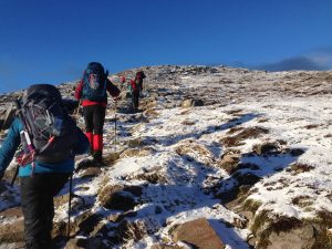
Finally we reached the end of the main path and the point at which we’d turned around on our previous visit. The rest of the route was across a boulder field, with the challenge of picking our way along increased by the snow.  Although this part of the walk was technically more difficult, the gradient was slightly less and I found it more comfortable. By this point all memories of our previous visit were receding and I was just grateful that we hadn’t slogged on up to the top on that occasion as it was so much more beautiful in the snow.

As with any self-respecting mountain there were a few false summits to tackle but the top was nearly in sight. We were beginning to see people coming back down off the top, all looking rather frozen and windswept.

Finally we were on the last climb, battered by the wind, but the views were incredible. We were treated to some small cloud inversions and the most exciting of spectacles – a Brocken spectre!

A bit of scrambling and were we up on the summit. We didn’t manage to last there too long as it was just too cold.

We made pretty good time heading back down again, I don’t think we’ve ever done a walk where we’ve stopped so little.

The icy patches seemed to have doubled whilst we were on the summit and it was quite a relief to finally make it back on to the lower path where it was both warmer and less skiddy underfoot. We eventually arrived back at the car at 3 o’clock, right on our prediction, which has to be a first! We even had time to take a small detour along the road (with a bonus red squirrel sighting) before heading back towards Aberfeldy and enjoying a very well earned hot chocolate and a piece of cake.

Route: WalkHighlands
Distance: 10.4km
Ascent: 715m
Hills climbed: Schiehallion (Munro)

Ben Lomond

On checking the mountain weather forecast for the weekend, there was a pretty similar pattern across Scotland – gale force winds on Saturday, calm and sunny on Sunday. That made my decision about which day to go hiking pretty straightforward, and given that I had to be in Glasgow on Sunday evening, meant that instead of heading up my closest stomping ground, the Cairngorms, the most logical choice was to head down to Loch Lomond so that I could get the most out of the day.

The clock change worked in my favour and made it easy to get a good start on Sunday and by 9.45am I was at the car park at Rowardennan and grumbling slightly to myself about the number of cars already parked there. After looking at a number of hikes in the area on WalkHighlands I’d decided to climb Ben Lomond, the most southerly of all the Munros, which is renowned for being busy due to its proximity to Glasgow. As I watched a bus disgorge a large number of passengers I worried that my choice meant that I’d be tripping over people all day and wondered if I’d made a mistake in my choice.  The presence of two families parked next to me with a collection of children and dogs, all chattering/barking incessantly made me glad that I’d spent quite some time reading the reviews of the hike on WalkHighlands and that I’d already decided to hike their route in reverse – climbing up by the lesser known Ptarmigan Ridge and returning back via the more populated tourist route. This turned out to be an excellent decision as I exited the car park in the opposite direction to everyone else and very quickly left the clamour behind.

I headed out along the shore of Loch Lomond, soon passing a memorial which I stopped to photograph, particularly enjoying the reflection of the trees on the sculpture.

The weather was showing every sign of living up to the forecast’s promise, and although it was cold enough that I started out with my fleece and hat, I was soon overheating and packing them back into my bag.

Reaching the Rowardennen Lodge Youth Hostel, I was a little unclear where the path went and felt a bit embarrassed wandering around looking for it whilst people were sat outside chatting. Fortunately this must happen often as I soon found a sign pointing me back towards the car park where I found another sign, complete with a very relaxed robin on top, which let me get close enough to get a few photos with my wide angle lens.

Following the sign I quickly found myself on a track heading into the woods. I knew that there should be one more turn off, which I found just after passing by a little stand selling bottles of water. The sign blended into the trees, so you had to be on the lookout for it.

Now that I was officially on the Ptarmigan ridge route it was very quickly time to leave the woods and start climbing. There was a clear path through the grass and bracken which took me past what looks like the ruins of an old dwelling.

As I climbed I stopped numerous times to photograph the view behind me down to Loch Lomond, breaking one of the cardinal rules of photography that you should never take a photograph into the light. Tough luck, that’s generally where the views were! With each little bit higher the perspective changed and yet another photo was warranted.

As I climbed higher, Loch Lomond receded further into the distance and the view ahead began to open up to the mountains on west side of the loch, including good views of The Cobbler, which is particularly distinctive. Another hill yet to be climbed!

Earlier I had a spotted a group of four along with a dog slowly catching up to me each time I stopped for a photograph. As we approached the climb up to the ridge I stopped to let them pass, worrying that I find it stressful having them on my heels when we got to the toughest part of the hike. One of my biggest uncertainties when setting out on the hike was how I was going to cope with the actual ridge, not having anything like a good head for heights. As it happens the ridge was still a little further ahead than I originally realised, but the worrying was beginning to niggle at me. The path started zig-zagging in earnest now and the loch looked ever more remote as I turned around for yet another photograph.

Finally, the view of what was to come opened out in front of me. I stopped and gulped a little when I realised that where I needed to be was a summit over to the right of me, and yet at the moment I was still climbing the summit in front of me. Clearly what lay between was the ridge, but I didn’t yet have a good view of what it was going to involve so I did my best to just focus on the climb ahead and worrying about the ridge when I got a bit further.

The views to the mountains to the north west were really opening up now.

By this point I was beginning to meet quite a few people coming down from Ptarmigan, including a few kids. I did think to myself ‘well, if they can do it, surely I can’, but then logic never does have much place when it comes to phobias! Having been sheltered most of the way up, it was now getting quite windy and with a temperature near freezing at the top, time to get the woollies out again.

I could now get a view of the ridge but couldn’t see where the path was. I was getting quite nervous at this point, but kept plodding upwards and reassuring myself that I could handle whatever it had to throw at me.

A little lochan provided a bit more photographic distraction along the way as I turned my back to Loch Lomond and headed inexorably towards the ridge.

Over the first wee summit and the ridge opened up to me finally. Hmm, well it’s not too bad, I thought. Not so much of a ridge with steep drops to either side as something rather steep to get myself up. ‘I can do this’, muttering to myself reassuringly.

One last photograph behind me and it was time to put my camera away so that I had free hands for the scramble and nothing flapping around to get in my way. It was beginning to look like a long way down.

No photos, therefore, of the actual scramble. Some of it was fairly decent, albeit steeply zig-zagging path. My heart was beating pretty fast by this point, a combination of fear and exertion. When I saw people coming down towards me I waited to let them get out of the way. I was terrified of finding myself in a position I was uncomfortable with and having to wait for them to pass. Then, I could see the top, one last scramble and I should be there.

No, a false summit. I had to stop a little and let my breathing settle before tackling what I really hoped was the final climb. Some of the gaps between the rocks were quite large and hard to manage with my short, wobbly legs and I had to fight back the panic, when I couldn’t quite figure out where the path was leading, but I carried on. One thing was for certain, going back wasn’t an option!

One last haul and I found myself on the summit, trig point in front of me, and a surprising number of people hauled out eating their lunch. I’d done it, and I was pretty pleased with myself for facing up to my fear.

I didn’t hang around for long, just enough to take a few photos and eat my lunch. The busload of people I’d seen in the car park turned out to be fundraising for Alzheimer’s Scotland and were filling the summit. I wanted to start heading down before I got stuck in the crowds, and the gorgeous views weren’t enough to compensate for the large number of people.

The path down leads worrying towards another ridge and I did think to myself ‘you’ve got to be kidding me’. Fortunately it wasn’t too intimidating and we quickly left the ridge to start dropping back down to the loch.


Although there were quite a few photo stops on my downhill journey the views weren’t as good as on the way up and I’d certainly recommend taking the Ptarmigan route rather than using the tourist path both ways. The late afternoon light, though, was fantastic.


The way back down was rockier than the Ptarmigan route and I didn’t find it very comfortable for my knees or my right ankle, which has been misbehaving the last few weeks. Not only was there a fairly constant stream of people coming past me downhill, but also a fair number of people still heading uphill and a few cows on the path for added entertainment. It certainly wasn’t as peaceful as my morning had been.


I returned to the car park almost exactly 6 hours after setting off – a bit longer than the WalkHighlands suggested time of 4.5-5.5 hours, which was not surprising given all the photos stops and my slower pace coming back down again.

Throwing my gingerbread biscuits on to the front seat, it was time to head into Glasgow to finish the day off by singing choral evensong. A perfect way to spend a Sunday and something I hope to do more often.

Route: WalkHighlands (in reverse)
Distance: 12.2km
Ascent: 953m
Hills climbed: Ben Lomond (Munro)

Loch Brandy

Sometimes things just align up perfectly. In this case, getting home from the hospital at lunchtime, the sun shining and Jen visiting. We both had the same idea – to get up into the hills. Loch Brandy, at Glen Clova, is a perfect destination for a short afternoon walk being just an hour’s drive from Dundee. Jen and I had visited here before almost exactly two years ago, so it was certainly about time we paid it a return visit.

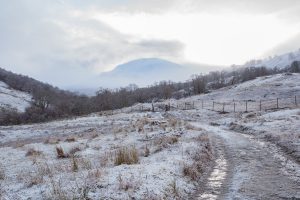
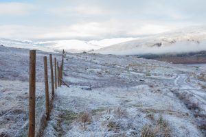
By the time we reached Glen Glova the clouds were coming in and our destination wasn’t looking quite as sunny as we’d hoped. Never mind, at least it was drier and less windy than on our previous visit. The initial climb is a bit of a steep slog, but photographing the atmospheric clouds over the neighbouring hills gave us plenty of excuses to stop for breathers.

Eventually the path levels off and things get a bit easier.

Just a little way further and a few steps to climb and the loch is in sight, every bit as attractive as I remember (although the best way to see it is surely from the air, which is how I first found out about it).

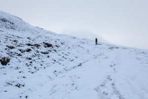
Within minutes, we were surrounded by mist and could only see a few metres ahead of us. Not a problem, though, the path is very clear so there was no danger of losing our way on the walk down!

Route: https://www.walkhighlands.co.uk/angus/loch-brandy.shtml
Distance: 5.5km
Ascent: 410m

Delft – Maassluis – Delft

Today’s walk was the longest yet until the Vierdaagse itself – 39.1km.  The route took me through the Vlietlanden to Schipluiden, Vlaardingen and Maassluis, mostly walking along the waterside.  A good route, and the early part to Vlaardingen and back would make a nice Sunday walk, with a bit of bird spotting thrown in.

I ended up taking an unexpected break about 20km into the walk, when I came across a man collapsed on the side of the path.  He was being assisted by another woman, who had called an ambulance, so I stayed to keep an eye on him whilst she tried to bring in the paramedics, who were stuck on the wrong side of a hump backed bridge.  In the meantime, a police man arrived on a motor cycle.  After some questioning, and the aid of the Breathalyzer, it appeared that the man was not seriously ill, but seriously drunk. 

Zandvoort aan Zee to Katwijk

This weekend’s walk was in the opposite direction from last week’s, south along the coast from Zandvoort aan Zee to Katwijk, with a small detour through the Nordwijkerhout along the way.  Unfortunately, having taken the Garmin along with me and recorded the route, I managed to wipe it out in my relief at reaching Katwijk at the end.  Fortunately not before I knew how far I’d walked – 25km.  As you can see, it was a typical grey, rainy day.

Scheveningen to Noordwijk

After a few weeks hiatus, I resumed my training for the Nijmegen Vierdaagse today with a walk through the dunes from Scheveningen to Noordwijk, about 20.5km.
The weather wasn’t ideal – muggy and overcast, and about halfway into the walk, very rainy.  For the sake of experimentation (and because I hadn’t charged up my GPS watch) I only used the iPhone (with the MapMyRun app) to record the route… very effective, but it also drained the battery very fast, so I stopped recording at Katwijk.  By the time I arrived in Noordwijk and wanted to look up the bus information, the battery was completely dead.  Not the smartest idea, thus.